
In April 2021, St. Vincent’s volcano reminded the hemisphere what living with an active peak means: La Soufrière’s eruptions evacuated the island’s north, dressed the country in ash, and wrote a fresh chapter in the oldest Vincentian story — a fertile, beautiful north built on the volcano’s terms. Recovery has been determined, the north is rebuilding and replanting, and building near the mountain now carries lessons no other island in this cluster can teach firsthand. Here they are, practically.
The volcano’s country, honestly mapped
The north’s building logic starts with the hazard geography the island now knows intimately: the monitored zones and their meanings, the valleys that channel volcanic flows and must never host what cannot be abandoned, the ridges and coastal shelves where communities rebuilt with reason, and the national systems — monitoring, alerts, evacuation practice — that turn living near an active volcano from gamble to managed relationship. Projects here begin with the official map and a conversation the rest of the Caribbean never has: what does this site do in an eruption scenario, and what should it never be asked to do?
Ash: the eruption’s longest chapter
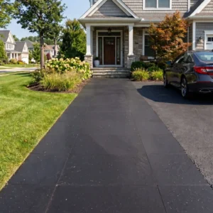
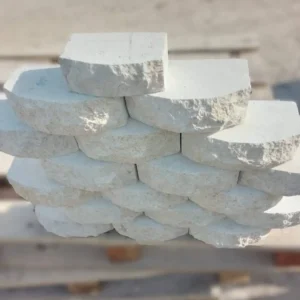
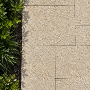
2021’s deepest practical lesson was ash — centimeters of it, on every surface, for weeks: roofs loaded, gutters choked, cisterns threatened, machinery abraded. Hard-landscape design absorbed the lessons directly: collection systems now build first-flush diversion and isolation valves as standard so a household can seal its water storage within minutes of an alert; falls and drainage size for ash-slurry, which flows like wet concrete and sets nearly as stubbornly; surfaces choose textures that sweep and hose clean rather than trap grit; and the recovery kit — brooms, shovels, sacrificial tarpaulins — lives with the storm-drill inventory. Stone itself shrugged the ash everywhere: swept, hosed, unmarked — one more argument for mineral surfaces in mineral country.
- Roofs loaded to a degree no ordinary design allowance covers.
- Gutters choked within hours and needing repeated clearing.
- Cisterns threatened by first-flush contamination.
- Machinery and pumps abraded by fine ash carried on every breeze.
- Hard surfaces that could be shoveled and hosed proving far easier than anything that trapped it.
Rebuilding: the north’s working present
The recovery years have run on pragmatic energy — homes rebuilt, farms replanted in famously regenerating volcanic soil, communities returned with infrastructure lessons applied — and construction in the north now carries recovery-era wisdom: build what can be cleaned, engineer what must survive, document for the insurance conversations the era normalized, and phase investment with the mountain’s temperament in the risk register. The repairable-surface philosophy reads differently here: repairability is not just storm logic but volcano logic — surfaces that recover by sweeping outlast surfaces that recover by replacement, categorically.
- Build what can be cleaned, which favors smooth-draining hard surfaces over anything textured to the point of trapping.
- Engineer what must survive, and accept that some elements are replaceable.
- Document everything for the insurance conversation that follows an event.
- Keep spares on the property, since post-event resupply competes nationally.
- Design drainage for ash-laden water, which behaves nothing like rain.
The north’s quiet opportunity
Beyond recovery, the north remains what it always was: the island’s most dramatic country — black-sand coasts, towering green interior, waterfalls and hot springs on the volcano’s flanks, and land at values the sheltered south forgot decades ago. Careful projects are returning: eco-lodges on the nature-first model framing the mountain rather than fearing it, villa builds on the reasoned coastal shelves, agritourism following the replanted estates. The building rules are this post’s: sited by the map, engineered for the scenario, surfaced for the sweep — and rewarded with landscape the postcard islands cannot match.
Hot ground, mineral water: the volcanic amenities
The mountain gives as it takes: the north’s flanks carry the volcanic-neighborhood amenities — hot springs, mineral streams, the drama of living geology — and the stone rules travel from the cluster’s other volcanic addresses: dark stone and relaxed expectations where mineral water flows, inert materials where sulfurous air visits, bathing courts built reverent and robust. Vincentian wellness tradition has soaked in these waters for generations; new projects join the tradition on its terms.
Respecting the teacher
Building near La Soufrière is ultimately a posture: the mountain is the north’s landlord, teacher and occasional editor, and projects that thrive hold all three truths — engineering to the hazard map, designing for the ash chapter, and honoring a community whose relationship with the peak is generations deep. The national supply guide serves northern projects with the era’s lessons built in: mineral surfaces, sweep-clean textures, sealable water systems and spares as policy. The volcano wrote the specification; the north builds by it.
Before the mason: reading the volcano’s paperwork
Building in the north starts at a desk, not a site. La Soufrière is the region’s most closely watched volcano — monitored continuously, mapped repeatedly, its hazard zones published and revised after 2021 — and the paperwork is the north’s first building material. Zone literacy comes first: which designation the parcel carries, what that meant in the last event, and what it implies for insurance, finance and the simple human question of how far the road runs before it meets the exclusion line when the mountain stirs. None of this forbids building — the north’s villages are its proof of settled life — but all of it shapes what building responsibly means.
The design consequences are practical. Roof geometry and gutter sizing treat ashfall as a known load rather than a surprise; cisterns take first-flush diverters seriously because ash and water systems must be separable in an event week; access and turning space anticipate the days when everything on wheels moves at once; and the property’s stone ground earns its keep twice — surfaces that sweep and wash clear of ash without damage, and hard aprons that keep recovery machinery off saturated ground. The community layer is the north’s real infrastructure: knowing the village’s assembly points, the monitoring bulletins’ rhythm, and the neighbors who have done this before and will again, calmly.
The honest summary for buyers is the one northern families give: the mountain is a neighbor with a file, and you read the file before you move in. Projects that start with the maps, design for the ash and join the community’s preparedness culture build the north’s actual standard — which is not defiance of the volcano but fluency with it, written in drainage, cisterns and stone that cleans fast when the sky has been busy.
What the mountain actually is
Building in the north is easier once the volcano is described in numbers rather than in memory. The Smithsonian Global Volcanism Program profile for Soufriere St. Vincent sets out the essentials.
- A stratovolcano rising to 1,220 m, or 4,003 ft, in the Lesser Antilles arc.
- A summit crater about 1.6 km wide, on the southwestern margin of a 2.2 km caldera.
- A separate crater formed in 1812 cutting the northeastern rim.
- A catastrophic 1902 eruption that devastated the northern island, coinciding with Mont Pelee.
- An explosive 1979 eruption that destroyed a lava dome and ejected the crater lake.
- Dome growth from 2020 and explosive activity with pyroclastic flows in April 2021.
- Erupted material largely basaltic andesite, at around 55 percent silica.
How much of the country lives with this
Hazard mapping is not an abstraction here; it describes where a substantial share of the population actually lives. The World Bank building regulatory capacity assessment for Saint Vincent and the Grenadines records the figures.
- Approximately 15 percent of the island population lives in the very-high and high-hazard volcano zones.
- The Town and Country Planning Act 2008 governs development control nationally.
- The Physical Planning Unit operates under a fifteen-member Physical Planning Development Board.
- The OECS Building Code is the technical standard in use.
- Around 70 percent of housing construction uses concrete and block for outer walls.
Detailing for ash rather than for rain
Ash is the design case in the north, and it behaves nothing like the weather most specifications assume.
- Surfaces that can be shoveled without damage, which rules out delicate finishes.
- Falls steep enough to move a heavy slurry rather than clear water.
- Gullies and channels sized generously and reachable for clearing by hand.
- First-flush diverters on every cistern collection route.
- Pale surfaces accepted as needing washing, since ash marks everything equally.
Building near a volcano and why surfaces fail here
They fail because they were specified for rain. Ash loads roofs, blocks gutters, contaminates cisterns and abrades machinery, and the surfaces that come through are the ones that can be cleared with a shovel and a hose. Add hazard-aware siting that keeps valuable things out of flow valleys, drainage sized for slurry, spares held on the property, and documentation ready for the insurer, and the north becomes a place to build with confidence rather than caution. Where the coastline turns dark, our black sand beach design guide covers the palette. Design for ash, not for rain, and the mountain becomes a neighbor rather than a risk.