
In 2005 St. Kitts closed the sugar industry that had defined it for three centuries, and the island inherited a question the size of its own landscape: what becomes of the cane land? Two decades on, the answer is being built — new neighborhoods on former estate ground, agriculture diversifying into the old fields, resorts and villas taking the sea-view slopes the cane once monopolized — and the transition is the federation’s biggest land story since emancipation. Here is the freed-land guide.
Reading estate ground
Cane land carries its history in its structure: field walls and boundary cairns from the estate centuries, ghaut crossings and cart roads as the old circulation, ruins — mills, boiling houses, the heritage register — anchoring parcels, and soil and drainage patterns three hundred years of monoculture wrote. Development starts by reading: the landscape-heritage instinct applied at island scale, old walls conserved as the new neighborhoods’ ready-made character, and the railway corridor threading the whole story together.
The new-neighborhood pattern
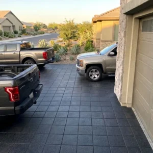
Housing on former estates runs the federation’s growth: government schemes and private subdivisions on the lower fields, the community-building manners governing how new streets meet old villages, infrastructure-first discipline — roads, drainage, utilities before rooftops — and the staged-family-build reality filling the plots. Ground craft carries the standard: street and drainage stone engineered for the ghaut-country rains, walls continuing the estate coursing, and public space — the new villages’ yards and greens — on the gathering-ground logic.
- Expect deeply worked soils rather than undisturbed ground on any cane parcel.
- Commission ground investigation rather than assuming a uniform bearing layer.
- Trace the old field drainage before setting levels.
- Allow for buried estate infrastructure that no current survey records.
Agriculture’s second act
The fields diversify rather than empty: vegetable and fruit operations at market scale, agro-tourism plots on the estate-visitor model, livestock on the higher grazing — with the vervet arithmetic written into every business plan — and farm infrastructure on working-grade stone: packing-shed aprons, wash-down floors, farm-track crossings over the ghauts. The land that fed the sugar economy learns new crops; its stone infrastructure is the same lesson at smaller, smarter scale.
The sea-view premium
The cane monopolized the island’s best views for three centuries, and their release built the modern property market: villa and resort parcels on the slopes, the citizenship-grade projects on the peninsula and shores, and the peak-view court genre flowering on ground a cane cart once ruled. The transition’s planning tension is real and managed: view land funds the economy, food land feeds it, heritage land remembers it — and the parcels that balance all three write the island’s next century.
- Confirm the subdivision approval status before committing to a layout.
- Read the access rights carefully, since old estate tracks are not always roads.
- Expect services to be newer than the plots and sometimes still provisional.
- Plan drainage at estate scale rather than parcel by parcel.
Heritage in the subdivision
The estates’ stone survivors — windmill towers in new gardens, boiling-house walls at cul-de-sac ends, aqueduct arches over access roads — are the transition’s character dividend, and their treatment runs the stewardship-not-improvement rule: ruins stabilized on arrest-not-restore manners, settings kept dignified inside private plots, public access negotiated where the monuments matter island-wide, and new work — walls, gates, entrance features — matched to the estate coursing so the neighborhoods inherit rather than impersonate. The ruins are the freed land’s memory; the new streets are its argument.
Specifying the transition
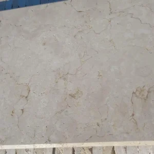
Freed-land work blends every register the federation runs: infrastructure stone for new streets, working grades for the second-act farms, heritage matching at the ruins, and view-parcel polish on the slopes — all on the federation supply line. The islands’ supply guide serves the island’s biggest land story in all its registers at once — because the cane’s three centuries left the federation its landscape, and what gets built on it now is the answer the next three centuries will read.
The estate’s old plumbing: water on freed land
Three centuries of cane farming were three centuries of water engineering, and the freed land’s development inherits the plantations’ hydrology whether it notices or not. The estates’ plumbing survives across the parcels: stone-lined channels and aqueduct runs that moved water to the works, pond dams — the estate ponds that watered stock and stilled sediment — sitting as landscape features with live engineering inside them, the ghaut crossings and check structures that managed the mountain’s delivery, and the field drains whose lines still decide where a wet season ponds. Development that maps this inheritance first builds better: the old channels either renewed as working drainage or formally decommissioned — never casually blocked, because water remembers its routes in the first serious rain; pond dams assessed by engineers before houses trust their shadows; and the ghaut-armor standard applied wherever new roads cross the old water lines.
The opportunity side matches the caution. Estate ponds restored become the new neighborhoods’ storm buffers and their prettiest commons; aqueduct fragments conserved anchor the heritage-dividend landscape with the one artifact class that photographs as beautifully as it worked; and the plantations’ terracing and check-wall logic, read carefully, is a free drainage masterplan for the slopes it already tamed once. The agricultural second act draws directly: the old pond-and-channel geometry serves the new farms’ irrigation as it served the old crop’s processing.
The specification habit that follows is survey-led: walk the parcel with the water question first, map the inherited works, and let the development’s drainage design negotiate with three centuries of tested engineering rather than overwrite it. The cane is gone; its plumbing still runs every storm; and the freed land builds driest where it builds informed.
What actually happened to this land
The ground under most new development on St. Kitts has a very specific history. The First Biennial Update Report of the Government of St. Kitts and Nevis records the government decision to close a 300 year old, loss-making sugar industry after the 2005 harvest, notes that much of the island virgin forest had been cleared mainly for agriculture, and describes vegetation succession and expanding secondary forest across the former sugar lands, particularly on the lower slopes.
- Treat the topsoil as three centuries of tillage rather than as natural ground.
- Expect compaction layers where machinery worked the same lines for decades.
- Allow for organic content that behaves badly under a slab.
- Read regrowth as an indicator of where water sits.
- Assume the land was drained for cane, not for buildings.
The permissions a subdivision actually needs
Turning estate land into plots is a regulated process. The Development Control and Planning Act requires permission for building operations, material changes in land use and subdivisions, allows the Board to designate environmental protection areas within development plans after adequate publicity and representations, requires environmental assessment for development in the Third Schedule, and gives ninety days for a decision before an application is deemed refused.
- Confirm the subdivision consent rather than relying on a seller assurance.
- Check whether an environmental protection area designation touches the land.
- Build the ninety day decision period into the acquisition timetable.
- Expect assessment on any scheme of scale rather than hoping to avoid it.
Building on ground that used to be farmed
Old cane land is not bad ground, but it is worked ground, and it behaves differently from the undisturbed slopes above it. Foundations, drainage and hard landscaping all have to answer a soil profile that people spent three hundred years modifying for a completely different purpose.
- Design foundations to the investigation rather than to the neighboring plot.
- Keep hard surfaces permeable where the old drainage still functions.
- Expect settlement in the first years and detail joints that can absorb it.
- Avoid rigid paving directly over a filled or leveled cane terrace.
Former cane land and what it asks of a build
Most of the buildable land on St. Kitts is a retired sugar estate, and it carries three centuries of tillage, drainage and leveling. Investigate the ground, trace the old water routes, confirm the subdivision consent and detail for movement. Our St. Kitts and Nevis stone supply guide sets out the formats, finishes and lead times that suit this federation. The cane stopped in 2005, but the ground has not forgotten what was done to it.